When you fly into Caracas, you fly into Maiquetía on the coast — at basically sea level, Maiquetía is everything you’d expect from a sweltering, languid coastal climate in the Caribbean.
![]()
The coast is really just a narrow strip of land, the ‘Litoral Central,’ prone to mudslides and which has a coastal attitude separated from Caracas proper by a mountain — El Ávila, which rises 8,000 feet from the coast before cascading back down into a valley of around 3,000 feet.
That’s Caracas, there in the valley, which enjoys more temperate weather than the coast from which El Áliva separates it. But as the city has grown exponentially to include up to 3 million residents since its initial burst of oil-fueled growth in the 1950s, Caracas has expanded out from the valley and into the mountains above.
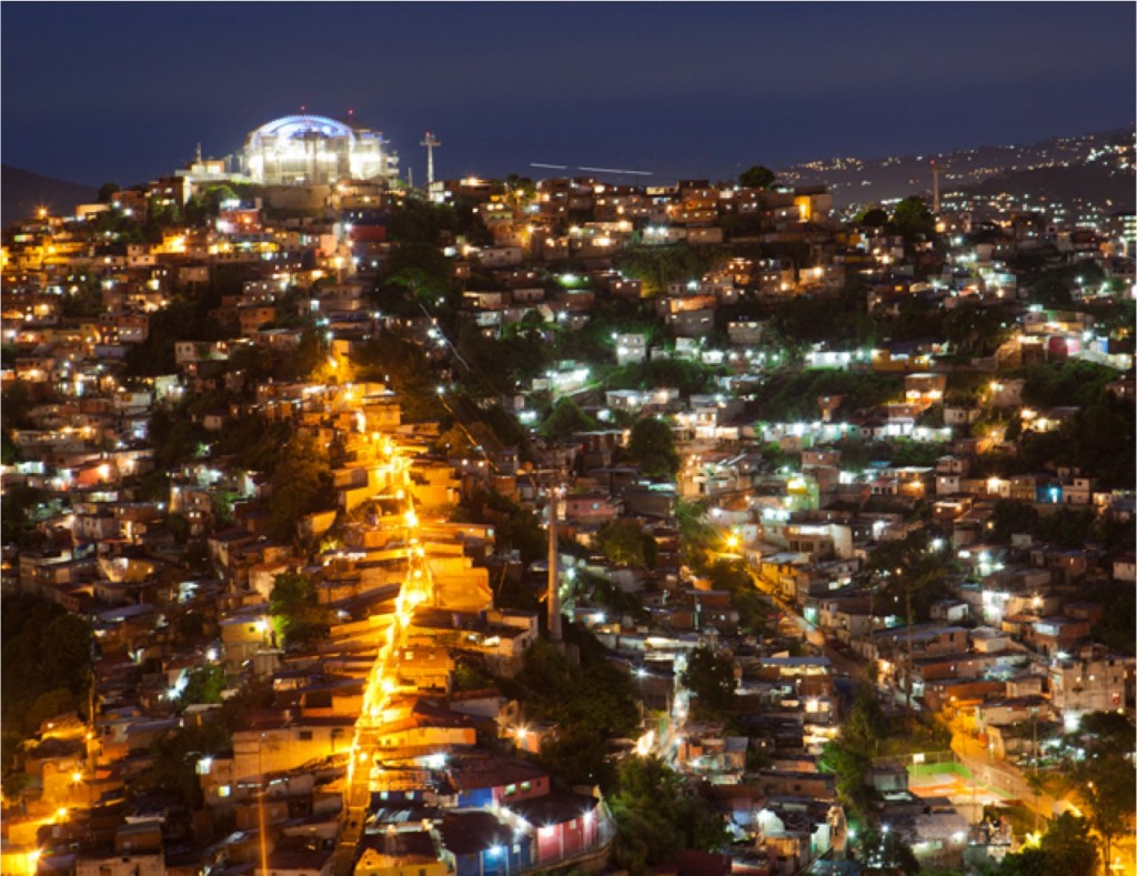
So when you come into Caracas, you drive first from the coast up to the mountains, where your first impression is a sea of shanties in the barrios overlooking the valley.
Though there’s an east-west socioeconomic divide (unlike London, Caracas’s east side is tonier), the central geographic feature of Caracas is that the higher up you go, the poorer it gets. Like Lima (pictured below) or the famous favelas of Rio de Janeiro, the best real estate is owned by the poorest residents of the city.

That’s ultimately at odds with the norm throughout much of the rest of the world, where the highest real estate belongs to the wealthiest. Think about New Orleans in 2005 — the wealthier Ninth Ward was spared the brute force of Hurricane Katrina that essentially destroyed lower-lying areas. Think of New York, and the consistent march of the aristocracy uptown in the 19th century. The same holds true of Los Angeles County and the Hollywood Hills, or of Montmarte in Paris or even cities like Port-au-Prince. I can’t find the link, but I’ve read studies that indicate this was because higher-elevation real estate was originally healthier when cities originally developed — farther from the sewage and other microbes further below.
Today, there’s not much risk of cholera or other 18th century illnesses afflicting anyone at any altitude in Caracas. But of course, much of the poverty in Caracas, and the corresponding violence that afflicts Caracas, (that’s made Caracas increasingly one of the most dangerous cities in the world), takes place in the barrios far higher than the valley below.
Top photo credit to Caracas1010a, bottom photo credit to Kevin Lees — Cerro San Cristobal, Lima, November 2010.